Page 2 of 4
Maps
This archive contains Middle Bass Island and Middle Bass Club maps from 1863 to 1905. The Sanford Fire Maps provide detail about the size and location of the Club House, Boat House, and Member cottages. This “original post” of the archive is dated: July 2021; the date of additions to this archive will be noted here so viewers can check for new content.
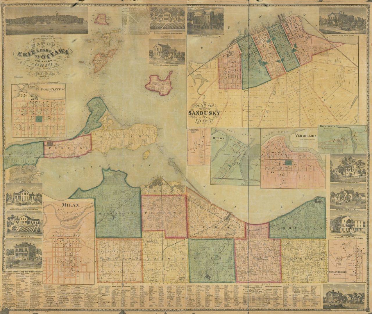
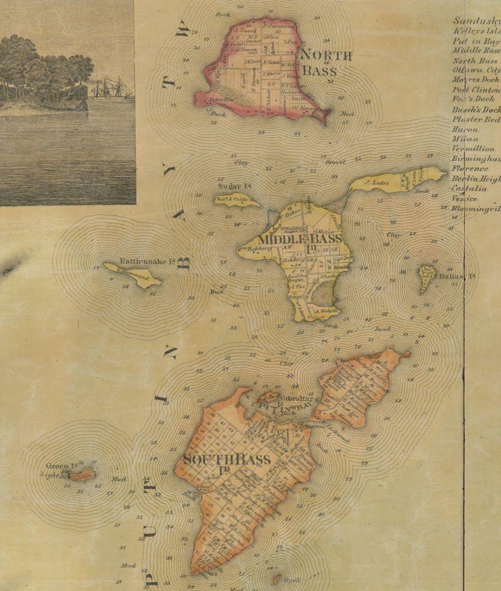
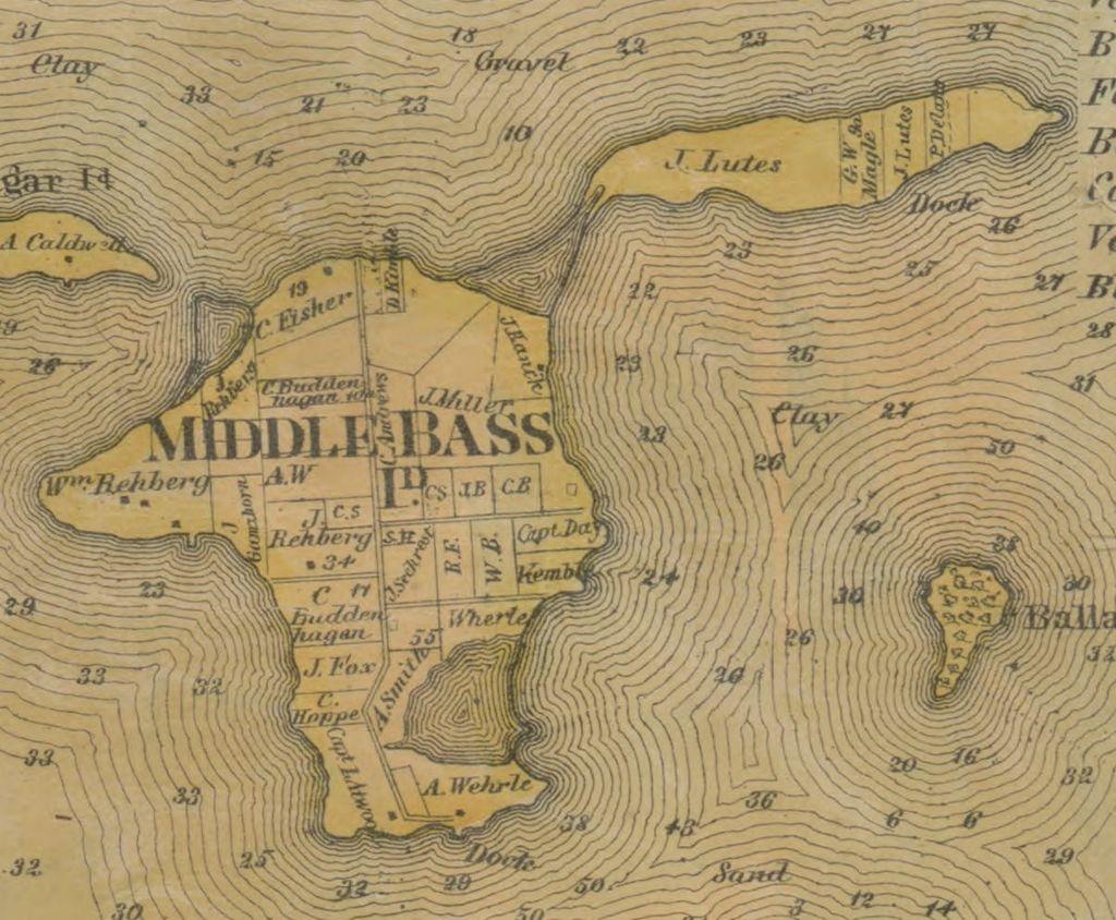
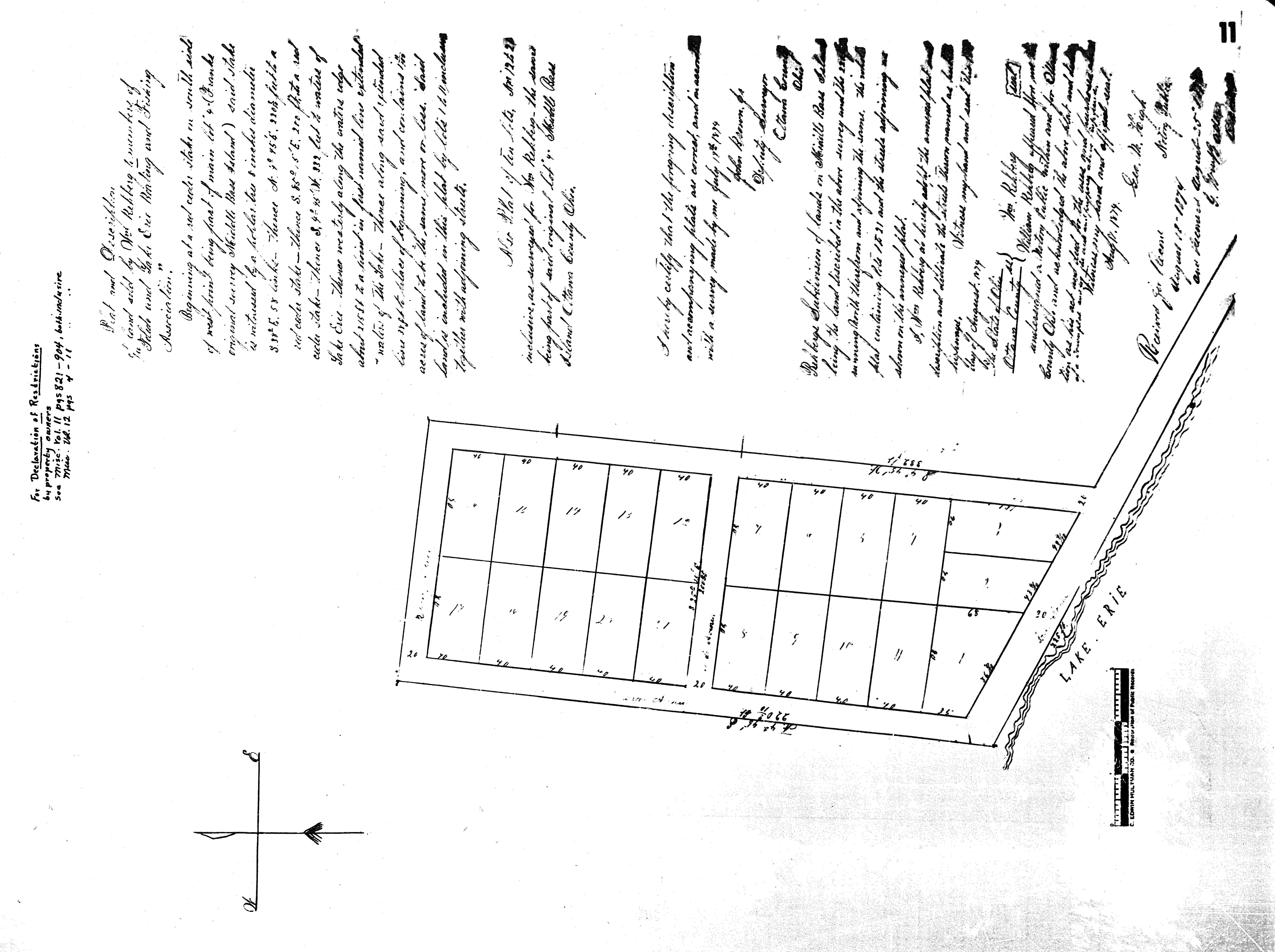
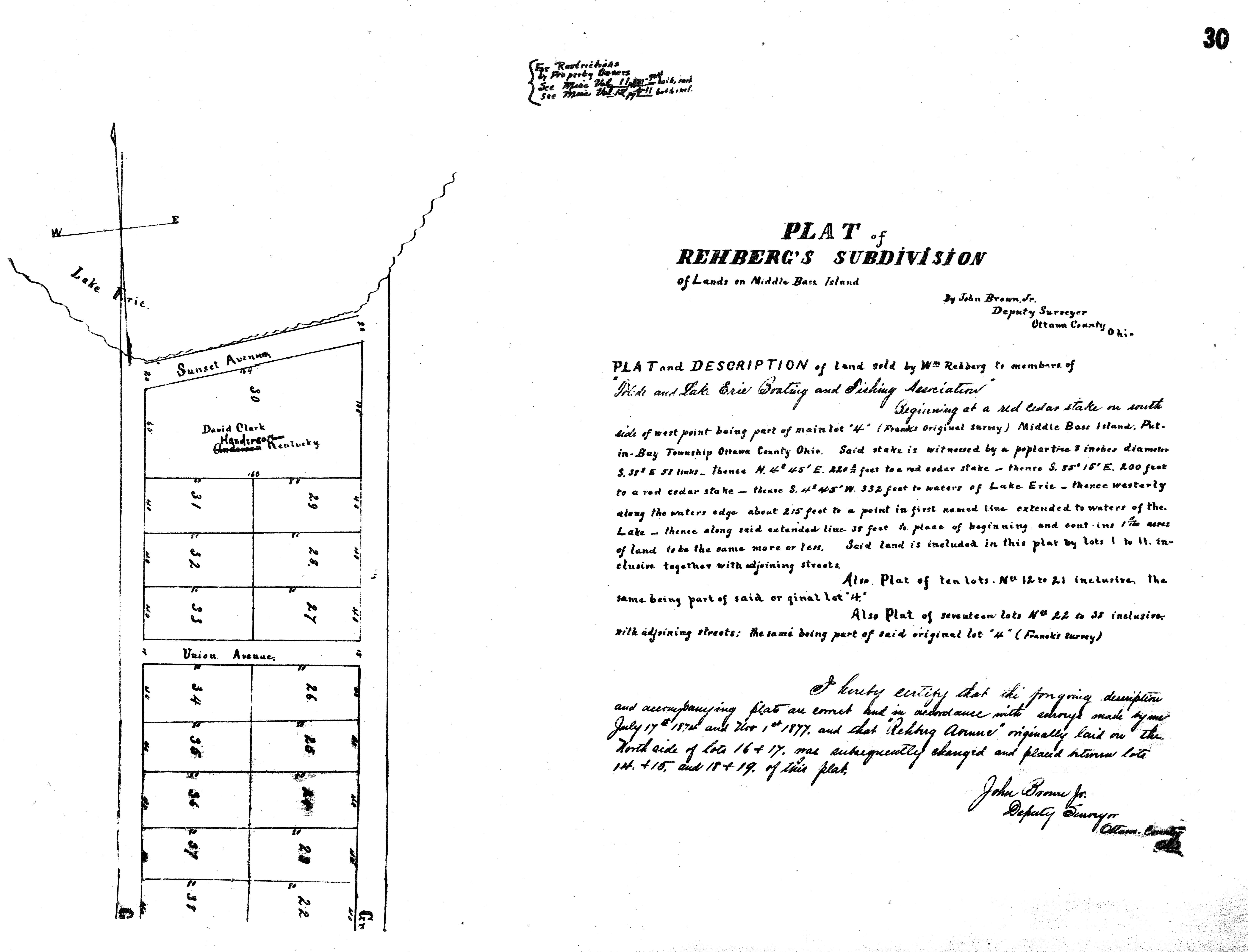
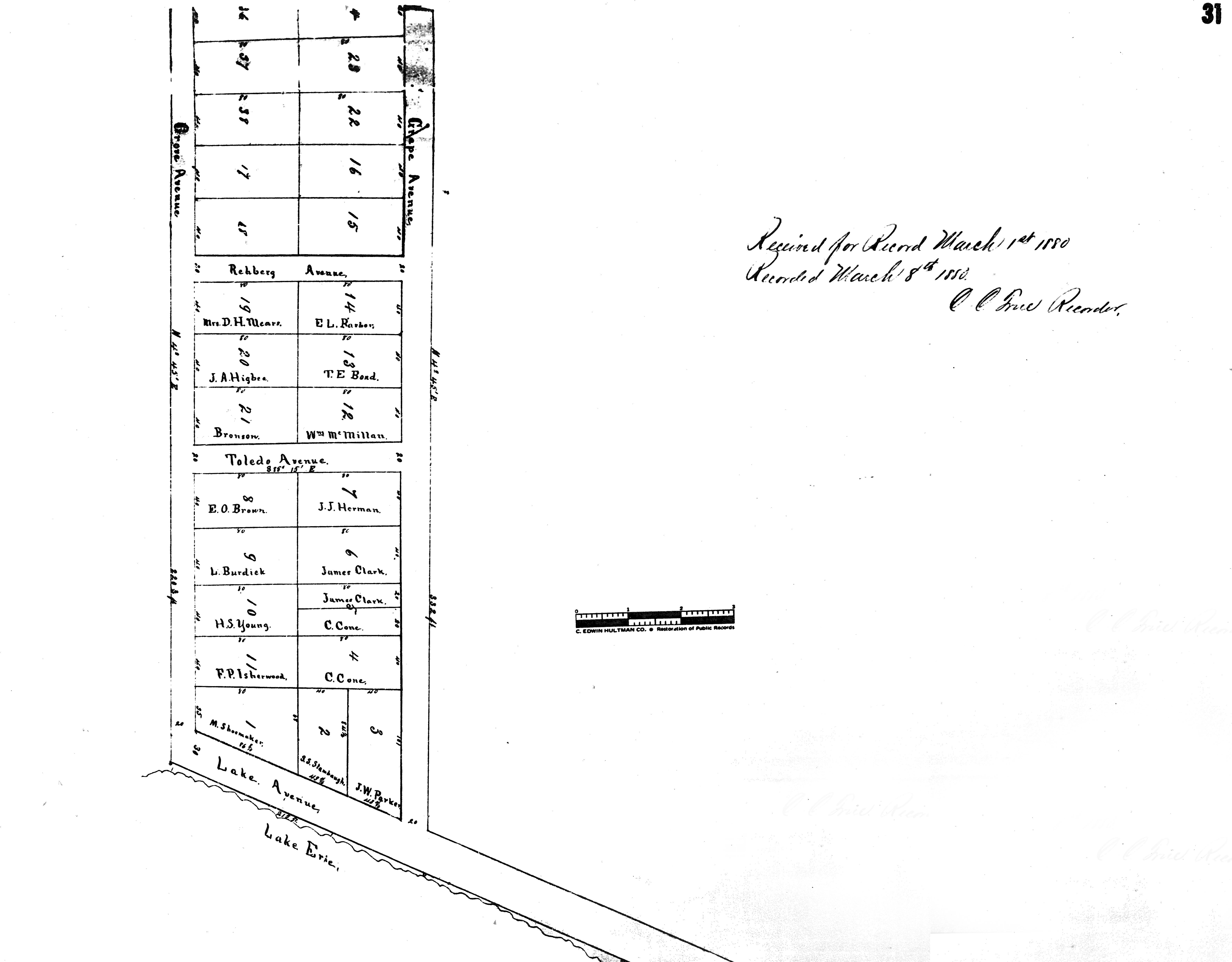
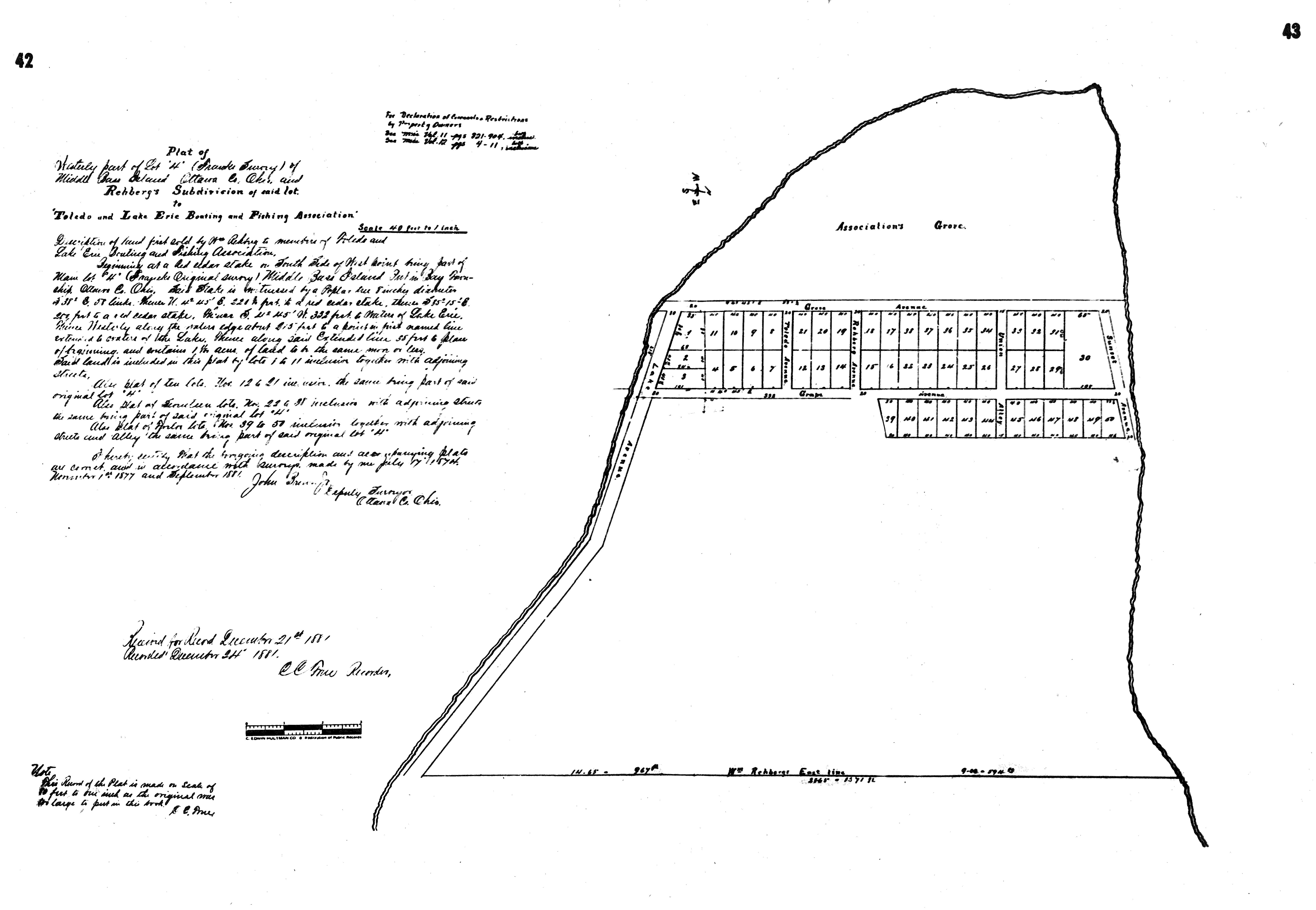
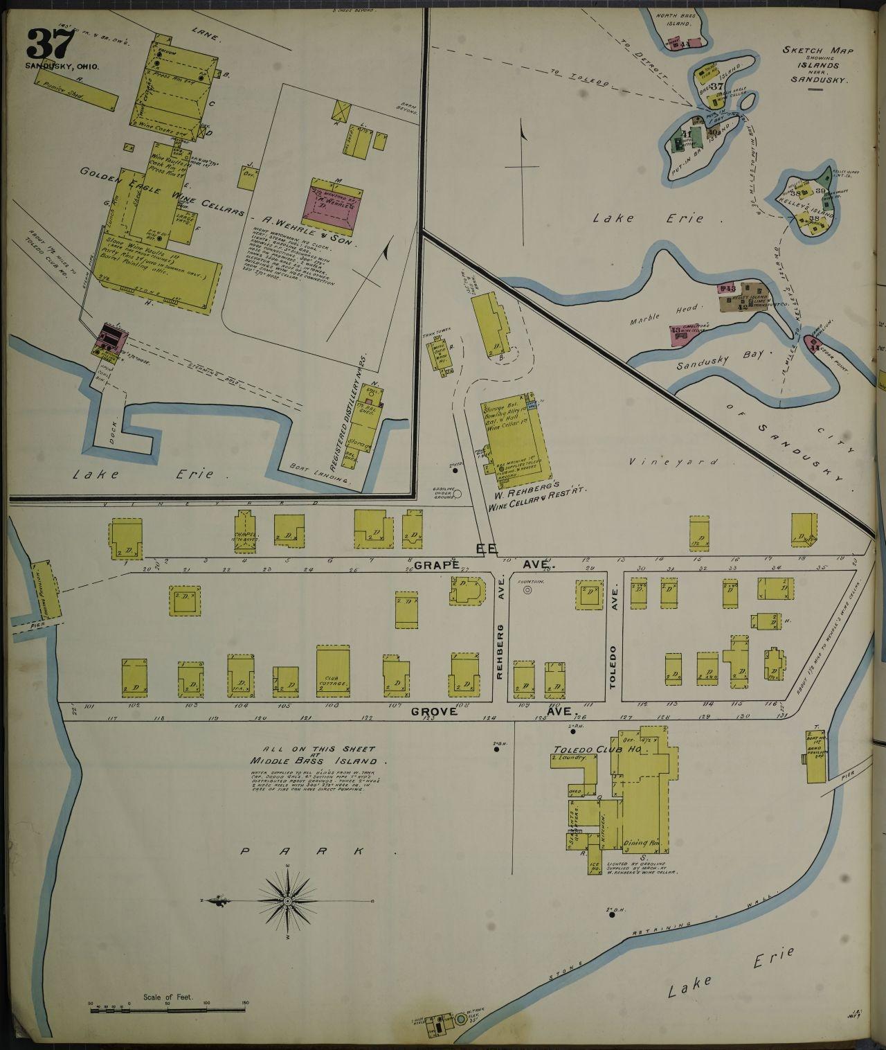
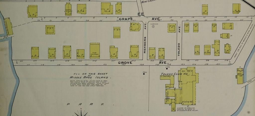
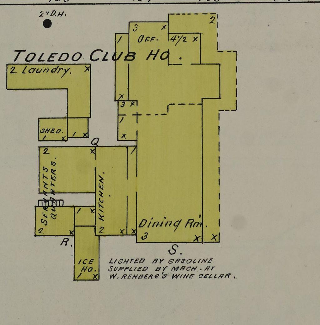
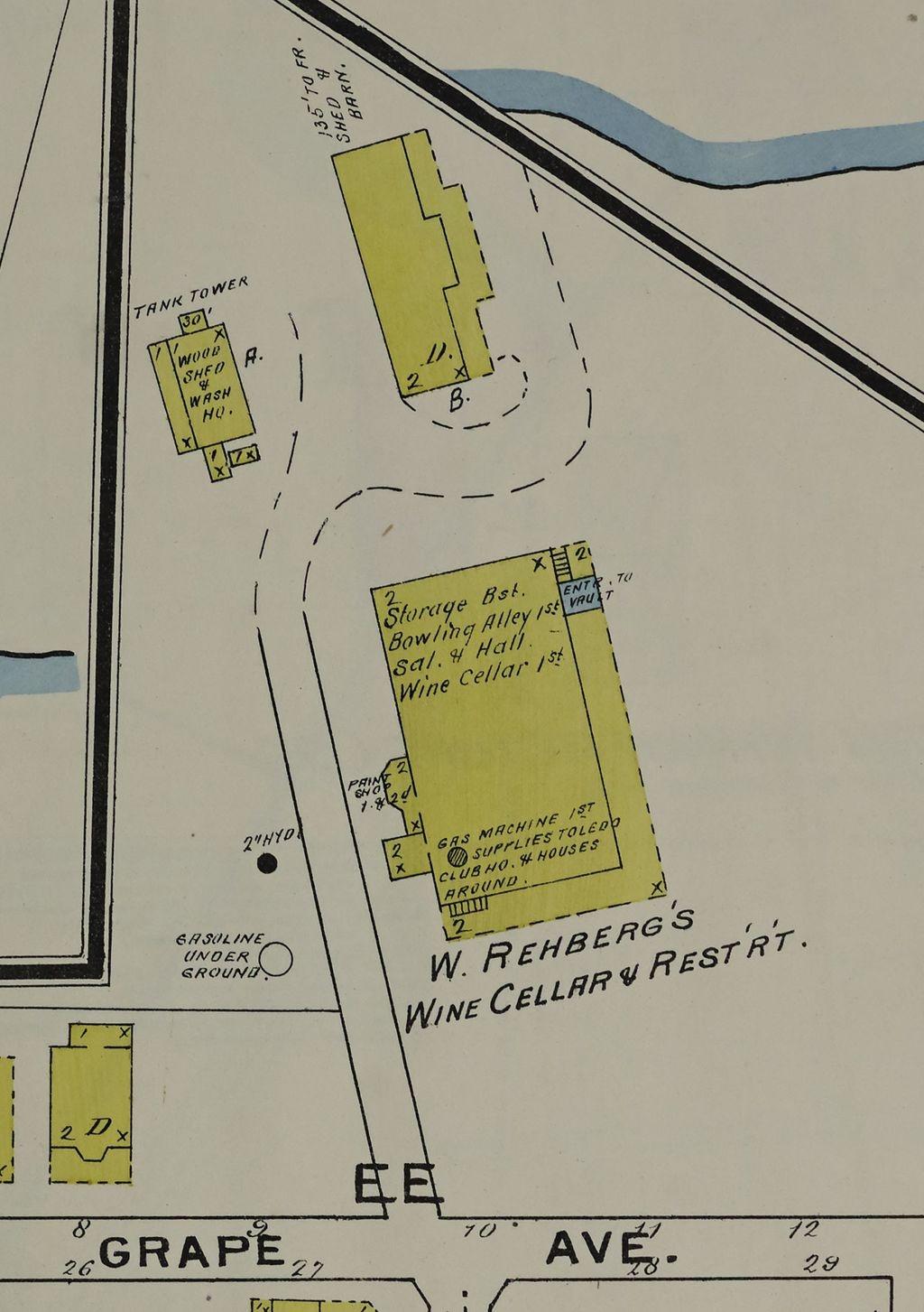
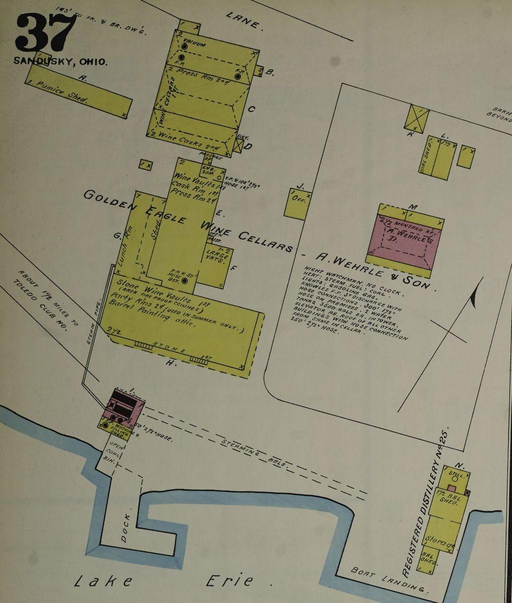
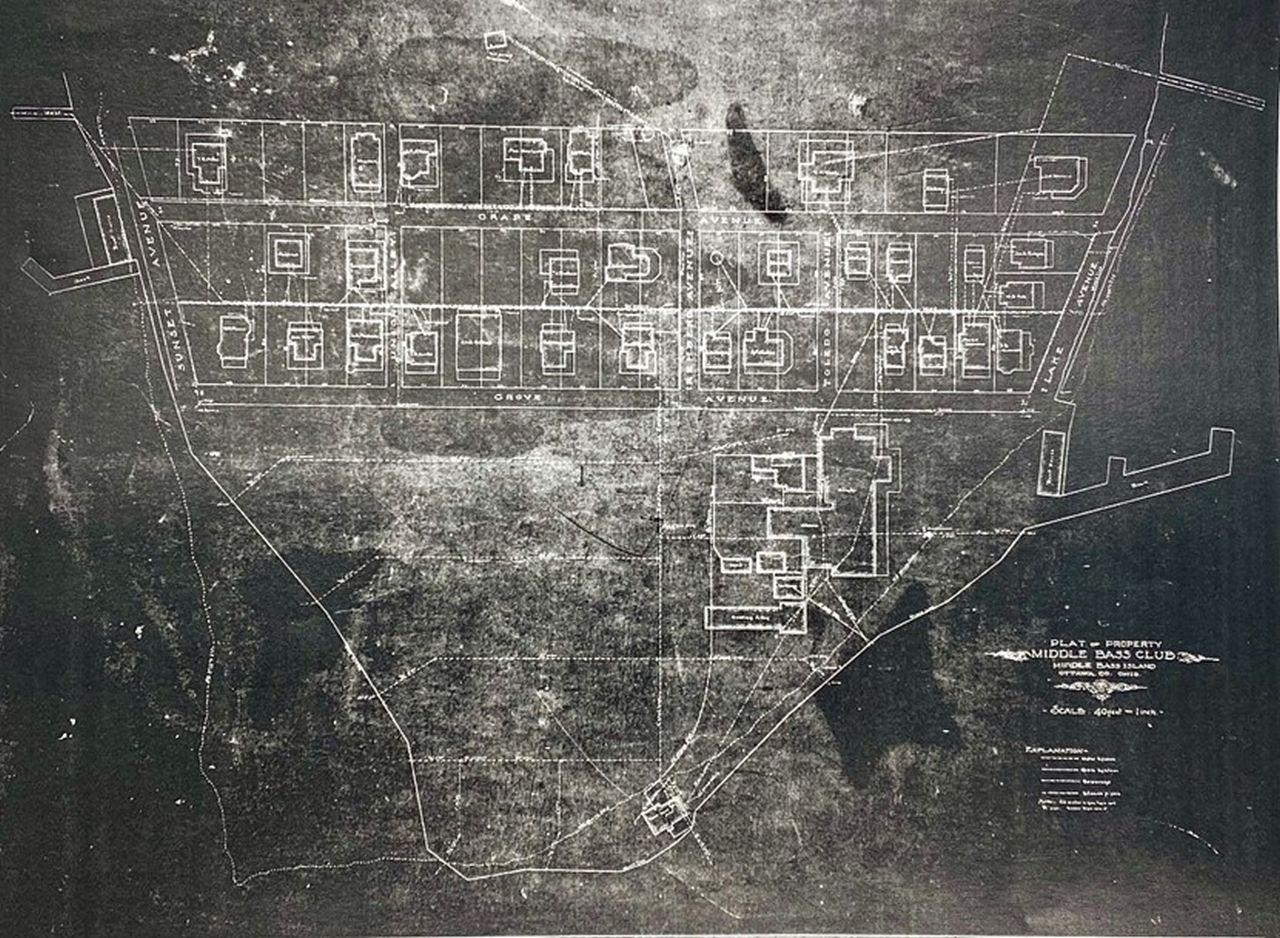
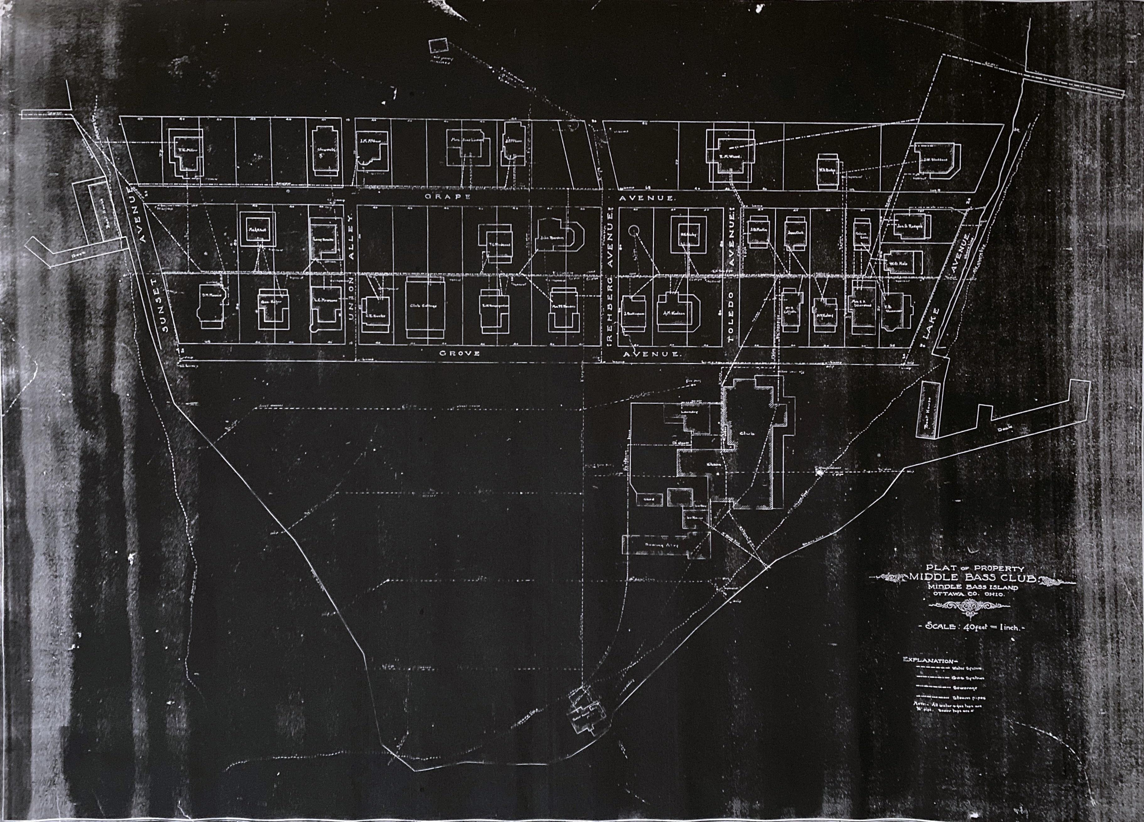
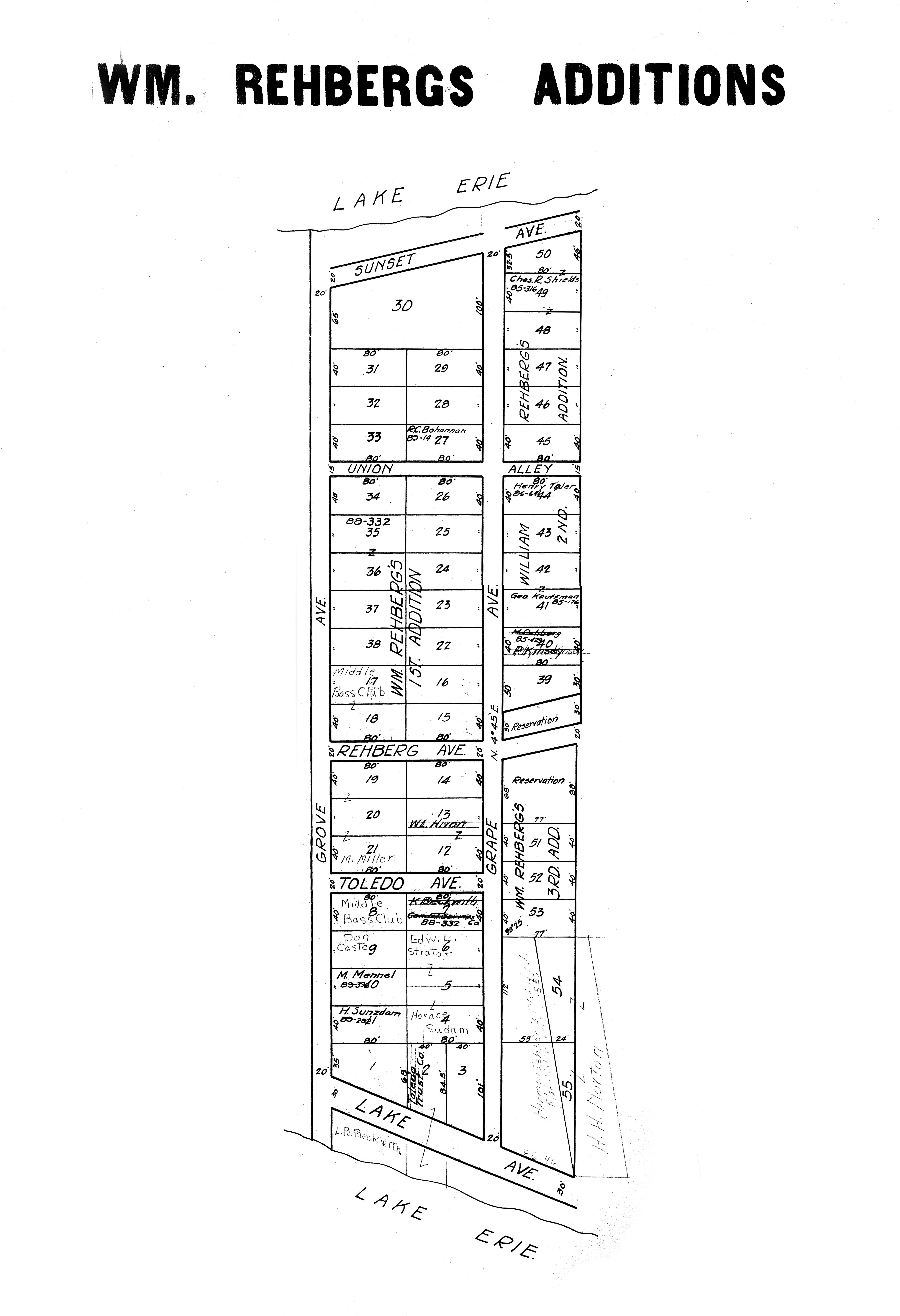

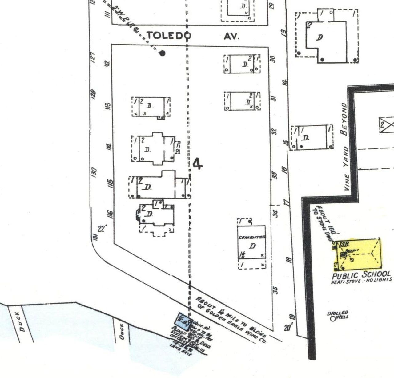
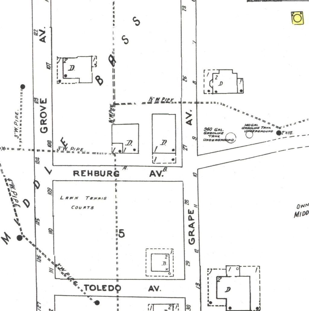
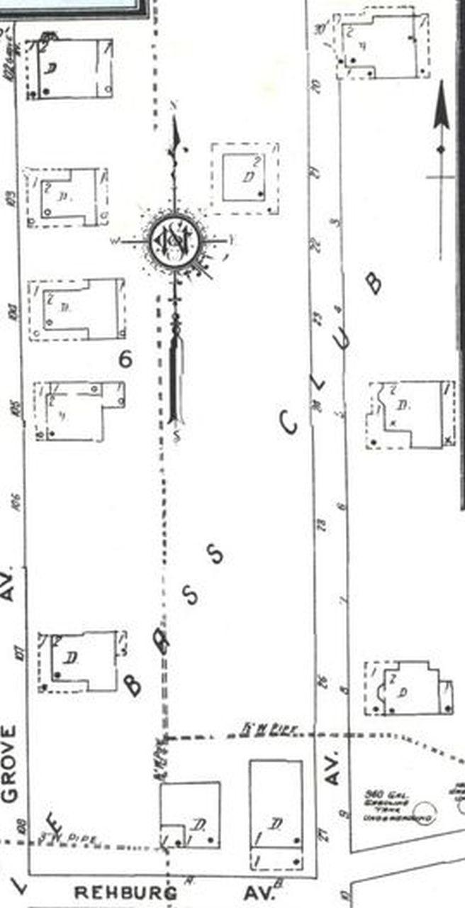
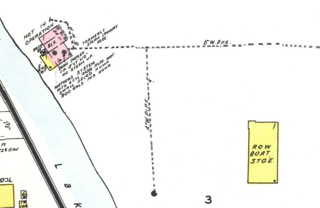
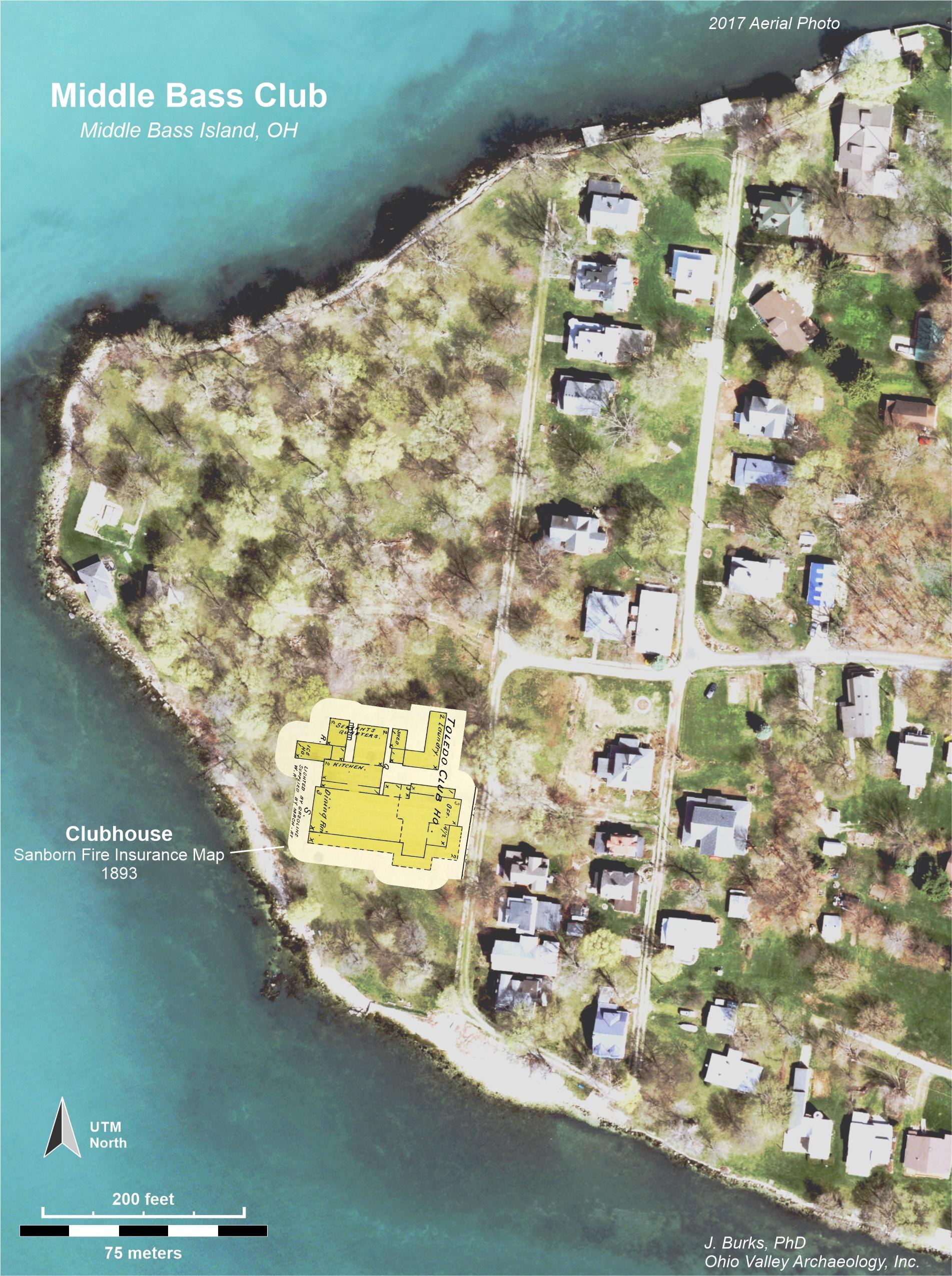
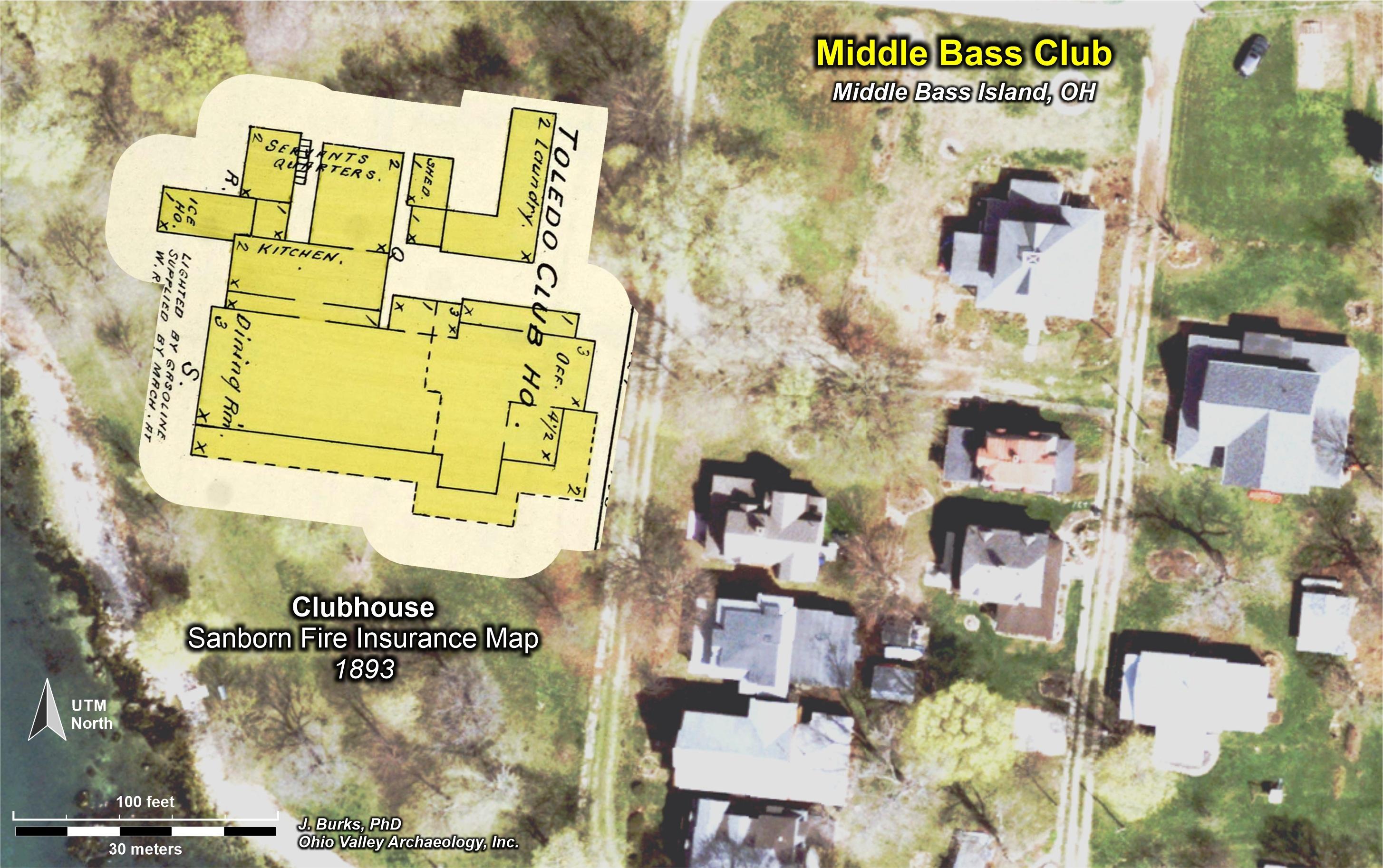
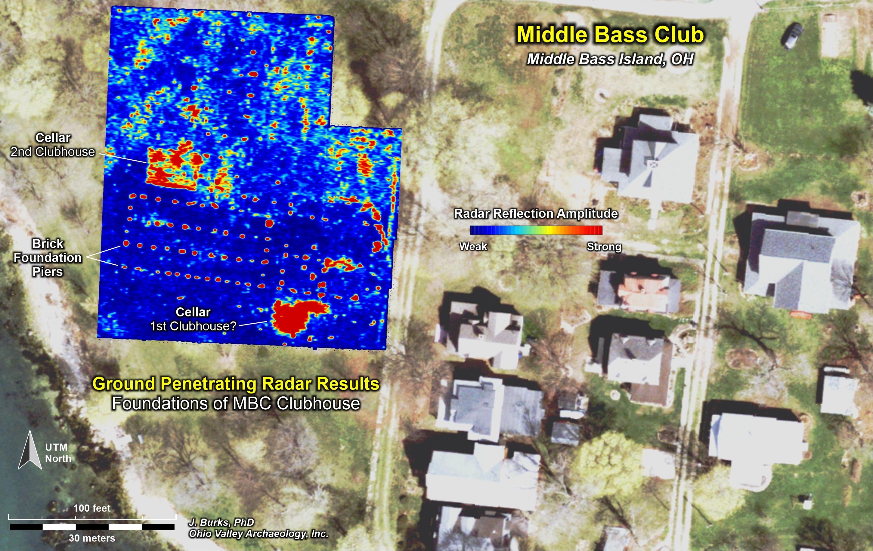
Image descriptions
- 1863 Map of Erie & part of Ottawa Counties, Ohio, Library of Congress.
- 1863 Map of Erie & part of Ottawa Counties, Ohio, Library of Congress: Focus on the 3 Bass Islands: North Bass, Middle Bass and South Bass.
- 1863 Map of Erie & part of Ottawa Counties, Ohio, Library of Congress: Focus on Middle Bass Island and west end of the island owned by William Rehberg. William Rehberg sold land to the Toledo and Lake Erie Boating and Fishing Association and to its members to build cottages.
- Plat and description of land sold by William Rehberg to members of the Toledo and Lake Erie Boating and Fishing Association. Original Subdivision with lots 1-21. August 1874. Source: Ottawa County Recorders Office, Digitized by Laura Reitz
- Plat and description of land sold by William Rehberg to members of the Toledo and Lake Erie Boating and Fishing Association. 1st Addition with lots 22-38. November 1877. Source: Ottawa County Recorders Office, Digitized by Laura Reitz
- Plat and description of land sold by William Rehberg to members of the Toledo and Lake Erie Boating and Fishing Association and the owners of the lots. Recorded 1880. Source: Ottawa County Recorders Office, Digitized by Laura Reitz
- Plat of waterly part of Lot '4'. Rehberg's Subdivision of said lot to Toledo and Lake Erie Boating and Fishing Association including lots 1 to 50. December 1881. Source: Ottawa County Recorders Office, Digitized by Laura Reitz
- 1893 Sanford Fire Map, image 37, Library of Congress. Middle Bass Island: Middle Bass Club, Rehberg Hall & Golden Eagle Wineries, A Wehrle & Son.
A blown up version of the 1893 Sanford Fire Map focusing on the Club House, Library of Congress. Middle Bass Island: Middle Bass Club, Rehberg Hall & Golden Eagle Wineries, A Wehrle & Son. - 1893 Sanford Fire Map, Library of Congress. Image is enlarged to showcase the Middle Bass Club House.
- 1893 Sanford Fire Map, Library of Congress. Rehberg Hall located just east of the Middle Bass Club. This is where Middle Bass Club members socialized and watched tennis.
- 1893 Sanford Fire Map, Library of Congress. Wineries on Middle Bass Island- Golden Eagle Wine Cellars, A Wehrle & Son.
- Plat of the Middle Bass Club, Approx. 1898-1904. Source: Dr. Martin Taliak Collection
- Plat of the Middle Bass Club showing cottages and their owners at the time, circa 1899, Source: Dr. Taliak Personal Collection, Digitized by Laura Reitz
- Plat of the William Rehberg subdivisions in the Middle Bass Club including lots 1 to 55. Source: Ottawa County Recorders Office, Digitized by Laura Reitz
- 1905 Sanford Fire Map, Library of Congress. Image 74 showcasing Middle Bass Island.
- 1905 Sanford Fire Map, Library of Congress: The south section of the Middle Bass Club focusing on Grove Avenue and Grape Avenue south of Toledo Avenue. Note the two club docks and lack of a Middle Bass Club Boat Houser and Club House.
- 1905 Sanford Fire Map, Library of Congress: The middle section of the Middle Bass Club focusing on Toledo Avenue and Rehburg Avenue. Note the lawn tennis courts.
- 1905 Sanford Fire Map, Library of Congress: The north section of the Middle Bass Club focusing on Grove Avenue and Grape Avenue north of Rehburg Avenue.
- 1905 Sanford Fire Map, Library of Congress: The grove of the Middle Bass Club, showing a Row Boat Storage shed and the former Steam Laundry facility as well as the Dunn Duplex and Mathews System.
- Maps of the Middle Bass Club with ground penetrating radar survey results and the 1893 Sanborn Fire Insurance map situated on a 2017 aerial photograph created by Dr. Jarrod Burks who is a member of the Middle Bass Club.
- Maps of the Middle Bass Club with ground penetrating radar survey results and the 1893 Sanborn Fire Insurance map situated on a 2017 aerial photograph created by Dr. Jarrod Burks who is a member of the Middle Bass Club.
- Maps of the Middle Bass Club with ground penetrating radar survey results and the 1893 Sanborn Fire Insurance map situated on a 2017 aerial photograph created by Dr. Jarrod Burks who is a member of the Middle Bass Club.